page search

Issuesland-use planningLandLibrary Resource
There are 6, 654 content items of different types and languages related to land-use planning on the Land Portal.
Displaying 4921 - 4932 of 6246

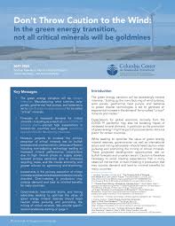
Strengthening civic spaces in spatial planning processes

Manuals & Guidelines
February, 2020
Global

This technical guide provides strategies on how to strengthen, protect and promote legitimate tenure rights in spatial planning processes at the local, regional and national levels. It addresses state authorities involved in spatial planning processes, national governments and local authorities, and those operating on behalf of the state or within customary governance systems.

Don't Throw Caution to the Wind: In the green energy transition, not all critical minerals will be goldmines

Manuals & Guidelines
April, 2020
Global

This note proves recommendations for governments, international actors, and mining advocates who seek to optimize the value of green energy mineral reserves, to ensure that expectations for green energy materials do not replace careful planning, impact assessment, and allocation of risks, as well as prevent over-production.

Urban Green Fabric Analysis Promoting Sustainable Planning in Guatemala City

Peer-reviewed publication
January, 2021
Guatemala
Central America

Urbanization rate in Central America is the second fastest worldwide and its major cities face challenges regarding urban sustainability. Urban Green Fabric (UGF) is an important material condition for the urban quality of life and, therefore, key to planning processes. We performed an analysis of the UGF of Guatemala City including the identification and classification of UGF, their spatial pattern analysis, construction of ensembles of districts (zones) and revealing citizen’s interactions with UGF.

Evaluation of Soundscapes in Urban Parks in Olsztyn (Poland) for Improvement of Landscape Design and Management

Peer-reviewed publication
January, 2021
Poland
United States of America

Soundscape analyses and noise measurements should be a part of pre-design works involved in planning green areas in city centers. The aim of the study was to conduct a multi-criteria analysis of the soundscape of three parks in Olsztyn (Poland) as a part of the landscape planning process to determine the directions of re-design of places most exposed to noise. The research included: 1. functional and spatial analysis of the park surroundings in reference to the city environment, 2. analysis of the acoustic map, 3.

Land-Use Planning and the Public: Is There an Optimal Degree of Civic Participation?

Peer-reviewed publication
January, 2021
Czech Republic
Hong Kong

Civic participation has an irreplaceable role in the land-use planning process because it contributes a practical perspective to expert knowledge. This article discusses whether there is actually a level of civic participation that can be considered optimal, which would allow experts to effectively obtain information from everyday users of the territory, who have the best practical knowledge of it; experts may also gain sufficient feedback on intended developments, based on knowledge about civic participation from representatives of individual municipalities.

GIS-Based Landslide Susceptibility Mapping for Land Use Planning and Risk Assessment

Peer-reviewed publication
February, 2021
Italy

Landslide susceptibility mapping is essential for a suitable land use managing and risk assessment. In this work a GIS-based approach has been proposed to map landslide susceptibility in the Portofino promontory, a Mediterranean area that is periodically hit by intense rain events that induce often shallow landslides. Based on over 110 years landslides inventory and experts’ judgements, a semi-quantitative analytical hierarchy process (AHP) method has been applied to assess the role of nine landslide conditioning factors, which include both natural and anthropogenic elements.

Taking Implementation Seriously in the Evaluation of Urban Growth Management Strategies: “Safeguarding the Future” of the Antwerp City-Region

Peer-reviewed publication
February, 2021
Belgium
United States of America

Contemporary evaluations of urban growth management (UGM) strategies often take the shape of quantitative measurements of land values and housing prices. In this paper, we argue that it is of key importance that these evaluations also analyse the policy formulation and implementation phases of growth management strategies. It is in these phases that the institutions and discourses are (trans)formed in which UGM strategies are embedded. This will enable us to better understand the conditions for growth management policies’ success or failure.

Emerging conflict in collaborative mapping: Towards a deeper understanding?

Journal Articles & Books

In spatial planning and environmental management, maps are found very helpful in many situations, but in other situations they may also deepen conflicts or be ignored. This paper addresses the question what explains such phenomena, with particular emphasis on, and reference to, collaborative policymaking settings in the Netherlands. We have elaborated the concept of ‘frames’ and ‘framing’ to structure and analyze the function of maps in the context of deliberative policymaking.

Clay resources in the Netherlands

Journal Articles & Books
December, 2006
Netherlands
Europe
Western Europe

Clay is a common lithology in the Dutch shallow subsurface. It is used in earth constructions such as dikes, and as raw material for the fabrication of bricks, roof tiles etc. We present a new national assessment of Dutch clay resources, as part of a project that provides mineral-occurrence information for land-use planning purposes. The assessment is based on a 3D geological model, which consists of voxel cells with lithological composition as primary attribute, and has been obtained by interpolating data of more than 380,000 digital borehole descriptions.

Methods and models for international comparative approaches to real estate development

Journal Articles & Books
December, 2016

Real estate development is a significant factor in planning the built environment. It shapes the way people live and work, and by doing so enables human activity to evolve. Real estate development forms a contemporary reflection of social, economic, environmental, and political forces at hand. Furthermore, due to globalization, we are increasingly witnessing similar trends for space despite institutional differences existing between countries and cities contained within their national borders.

Designing Open Spatial Information Infrastructure to Support 3D Urban Planning in Jakarta Smart City

Conference Papers & Reports
December, 2018

Land administration is essential for urban planning and Spatial Information Infrastructure (SII). Interoperability of land administration and spatial planning will determine the success of SII utilization. This information should be accessible to all member of SII, including businesses and the community. This article proposes spatial planning information as an extension of the Land Administration Domain Model (LADM), the ISO 19152:2012 in order to support spatial planning.

Remote Sensing for Land Administration

December, 2020

Land administration constitutes the socio-technical systems that govern land tenure, use, value and development within a jurisdiction. The land parcel is the fundamental unit of analysis. Each parcel has identifiable boundaries, associated rights, and linked parties. Spatial information is fundamental. It represents the boundaries between land parcels and is embedded in cadastral sketches, plans, maps and databases. The boundaries are expressed in these records using mathematical or graphical descriptions. They are also expressed physically with monuments or natural features.