Resources
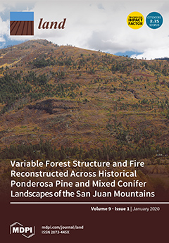
Displaying 1791 - 1795 of 2258Variable Forest Structure and Fire Reconstructed Across Historical Ponderosa Pine and Mixed Conifer Landscapes of the San Juan Mountains, Colorado
Late-1800s land surveys were used to reconstruct historical forest structure and fire over more than 235,000 ha in ponderosa pine and mixed conifer landscapes of the San Juan Mountains, Colorado, to further understand differences among regional mountain ranges and help guide landscape-scale restoration and management. Historically, fire-resistant ponderosa pine forests with low tree density and relatively frequent fire, the most restorable forests, covered only the lower 15%–24% of the study area. The other 76%–85% had dominance by mixed- to high-severity fires.
Changes in Land Cover and Urban Sprawl in Ireland From a Comparative Perspective Over 1990–2012
In this article, we first summarise trends of land use changes and urbanisation in Ireland since 1990 using data from the Corine Land Cover program. In doing so, we compare the developments in Ireland with other European countries. Second, we propose a statistical test for the presence of sprawl using conditional and unconditional convergence tests. The two-part empirical analysis allows us to establish that Ireland has experienced a substantial loss of non-urban land in recent decades.
Indigenous Protected and Conserved Areas (IPCAs), Aichi Target 11 and Canada’s Pathway to Target 1: Focusing Conservation on Reconciliation
This article provides analysis of the issues relating to movement towards new models for Indigenous-led conservation in light of Canada’s initiatives for greater protected areas representation through Target 1. We provide a background on Canada’s Pathway to Target 1, which is based on Target 11 from the Aichi Biodiversity Targets set forth by the Convention on Biological Diversity (CBD).
A Model for Estimating the Vegetation Cover in the High-Altitude Wetlands of the Andes (HAWA)
The natural salt meadows of Tilopozo in the hyperarid, Atacama Desert of northern Chile, which are located at approximately 2800 m above sea level, are under pressure from industrial activity, and cultivation and grazing by local communities. In this research, the land surface covered by salt meadow vegetation was estimated from normalized difference vegetation indices (NDVI) derived from Landsat Thematic Mapper (TM), Enhanced Thematic Mapper (ETM+) and Operational Land Imager (OLI) data from 1985 to 2016.
New 1 km Resolution Datasets of Global and Regional Risks of Tree Cover Loss
Despite global recognition of the social, economic and ecological impacts of deforestation, the world is losing forests at an alarming rate. Global and regional efforts by policymakers and donors to reduce deforestation need science-driven information on where forest loss is happening, and where it may happen in the future.


