Proportion of important sites for terrestrial and freshwater biodiversity that are covered by protected areas, by ecosystem type
Last updated on 1 February 2022
This indicator is currently classified as Tier I. The United Nations Environment Programme (UNEP) is the Custodian agency for this indicator.
Unit of measure: Mean percentage of each terrestrial and freshwater Key Biodiversity Area covered by (i.e. overlapping with) protected areas and/or Other Effective Area-based Conservation Measures
Sub Indicators: Average proportion of Freshwater Key Biodiversity Areas (KBAs) covered by protected areas (%), Average proportion of Terrestrial Key Biodiversity Areas (KBAs) covered by protected areas (%)
Why is this indicator important?
To bring the global decline in biodiversity to a halt and secure a long-term and sustainable use of terrestrial and freshwater natural resources, it is crucial to safeguard important sites. Establishing protected areas is an essential mechanism to reach this objective. SDG Indicator 15.1.2 measures progress toward the conservation, restoration and sustainable use of terrestrial and freshwater ecosystems and their services, in accordance with international agreements.
How is the indicator measured and monitored?
SDG indicator 15.1.2 measures the proportion of important sites for terrestrial and freshwater biodiversity that are covered by protected areas, by ecosystem type. Data derived from a spatial overlap between digital polygons for protected areas from the World Database on Protected Areas, digital polygons for Other Effective Area-based Conservation Measures (OECMs) from the World Database on OECMs, and digital polygons for terrestrial and freshwater Key Biodiversity Areas (from the World Database of Key Biodiversity Areas, including Important Bird and Biodiversity Areas, Alliance for Zero Extinction sites, and other Key Biodiversity Areas) is the basis for the calculation of the indicator. Protected areas are defined by IUCN as clearly defined geographical spaces, recognized, dedicated and managed, through legal or other effective means, to achieve the long-term conservation of nature with associated ecosystem services and cultural values.
According to the metadata document, the value of the indicator at a given point in time, based on data from the year of protected area establishment recorded in the World Database on Protected Areas, is computed as the mean percentage of each Key Biodiversity Area currently recognized. Disaggregation is available by national, regional, and global levels and ecosystem types. The indicator does not encompass degazetted sites that are not listed in the World Database of Protected Areas, as well as ‘proposed’ or ‘not reported’ sites and protected areas lacking digital boundaries.
International organizations responsible for global monitoring are the United Nations Environment World Conservation Monitoring Centre (UNEP-WCMC), BirdLife International (BLI), and the International Union for Conservation of Nature (IUCN).
By Anne Hennings, peer-reviewed by UNEP.
Official indicator data
Proportion of important sites for terrestrial and freshwater biodiversity that are covered by protected areas, by ecosystem type. This dataset provides a percentage of the mean proportion of Key Biological Areas (KBA) that are protected for their environmental values in both terrestrial ecosystems and freshwater ecosystems. * Select "year" below to see the most recent data for more countries. ** To refresh the map with other official data, use the ’Select an indicator field’. Type in the other indicators titles, as given in the table below.
| Indicator | Min-Max Number of years |
Countries / Obs | Min / Max Value |
|---|---|---|---|
| Average proportion of Freshwater Key Biodiversity Areas (KBAs) covered by protected areas (%) | |||
| Average proportion of Terrestrial Key Biodiversity Areas (KBAs) covered by protected areas (%) |
Other related indicators on Land Portal
Other related data: In addition to the official indicator data, the following indicators provide information related to terrestrial and marine protected areas and community or indigneous land rights in protected areas.
| Indicator | Min-Max Number of years |
Countries / Obs | Min / Max Value |
|---|---|---|---|
| Marine protected areas (% of territorial waters) | |||
| Terrestrial and marine protected areas (% of total territorial area) | |||
| Terrestrial protected areas (% of total land area) | |||
| X - Land Rights in protected areas - Community Lands | |||
| X - Land Rights in protected areas - Indigenous People |
Green Climate Fund makes first payment to Brazil for efforts to reduce deforestation
It’s now been over 10 years since countries around the world started to work on the international policy framework known by reference as the acronym REDD+, which stands for ‘reducing emissions from deforestation and forest degradation, conservation and sustainable management of forests and enhancement of forest carbon stocks.’
Advocacy for the implementation of environmental laws
CANBERRA — A report from the U.N Environment Programme released last month seeks to make governments look beyond environmental law, and focus on gaps in implementation.
The report analyzes the global environmental rule of law and provides an important evidence base to help advocacy efforts on proper enforcement of laws.
“Governments talk about how good their laws are but they don’t necessarily talk about how these are being implemented.”
Water For All
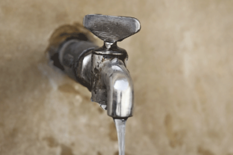
WATER. The most basic necessity that most people take for granted because it is readily available by just a turn of the tap.
But for some groups in Malaysia, safe drinking water and sanitation is not accessible.
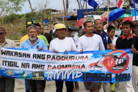
The superhighway threatening Nigeria's tropical rainforest

When bulldozers rolled into their forest at the start of last year, the Ekuri community in southeast Nigeria protested: "Indigenes say no!"
They didn't want a superhighway that would wipe their ancestral lands in the Cross River National Park off the map.
Under pressure, the earthmovers left to do their work elsewhere.
But community spokesman Martin Egot said: "They destroyed all the crops, the source of our wealth: cassava, cocoa, plantain... ."
Metadata on SDGs Indicator 15.1.2

Indicator 15.1.2: Proportion of important sites for terrestrial and freshwater biodiversity that are covered by protected areas, by ecosystem type
“Global Safety Net” to reverse biodiversity loss and stabilize Earth’s climate

Global strategies to halt the dual crises of biodiversity loss and climate change are often formulated separately, even though they are interdependent and risk failure if pursued in isolation. The Global Safety Net maps how expanded nature conservation addresses both overarching threats.
Strengthening protected areas for biodiversity and ecosystem services in China
Recent expansion of the scale of human activities poses severe threats to Earth’s life-support systems. Increasingly, protected areas (PAs) are expected to serve dual goals: protect biodiversity and secure ecosystem services.
Changing livelihoods and protected area management: a case study of charcoal production in south-west Madagascar

Protected areas are usually conceived and managed as static entities, although this approach is increasingly viewed as unrealistic given climate change and ecosystem dynamics. The ways in which people use land and/or natural resources within and around protected areas can also shift and evolve temporally but this remains an under-acknowledged challenge for protected area managers.
Evidence for Biodiversity Conservation in Protected Landscapes

A growing number of protected areas are defined by the International Union for Conservation of Nature (IUCN) as protected landscapes and seascapes, or category V protected areas, one of six protected area categories based on management approach. Category V now makes up over half the protected area coverage in Europe, for instance.
![]()

By 2020, ensure the conservation, restoration and sustainable use of terrestrial and inland freshwater ecosystems and their services, in particular forests, wetlands, mountains and drylands, in line with obligations under international agreements
Indicator details
The Indicator is conceptually clear, has an internationally established and available methodology and standards, and that data is regularly produced by countries for at least 50 per cent of countries and of the population in every region where the indicator is relevant.
Key dates: