page search

IssuesmonitoringLandLibrary Resource
Displaying 1 - 12 of 194

VGGT: Manual on Land Monitoring. How to establish an effective land monitoring initiative

Manuals & Guidelines
December, 2013
Global

Guide to determine if monitoring is actually a viable activity that can be undertaken by their organisation. Choosing to undertake monitoring is dependent on considerations such as evaluating the sufficiency of resources, capacity to design a sound monitoring system, and availability of political windows to effect change, amongst others.

Monitoring land-based investments in Sub-Saharan Africa (SSA): review of existing initiatives and options on way forward for developing a monitoring system

Reports & Research
November, 2014
Africa
Western Africa

Monitoring land-based investments in Sub-Saharan Africa (SSA): review of existing initiatives and options on way forward for developing a monitoring system

Monitoring Scheme for Monitoring Large Scale Agricultural Investments in Ethiopia

Manuals & Guidelines
May, 2019
Ethiopia

This manual illustrates a monitoring scheme for monitoring large-scale agricultural investments. It aims at providing orientation for establishing a monitoring scheme and implementing monitoring activities in the framework of LSAI with the collaboration of the authorities responsible for leasing out land to agricultural investors and supervising related activities. While focused on Ethiopia, it will be a useful resource for other countries too.

Application of systematic monitoring and mapping techniques

Journal Articles & Books
September, 2018
Eastern Africa
Kenya

Drylands cover over 40% of the earth's surface and support over 2 billion people, globally (Millennium Ecosystem Assessment, 2005). In East Africa alone, over 250 million people depend on drylands for their livelihoods (De Leeuw et al., 2014) and in Kenya, 70% of the total land area is classified as arid- and semi-arid (Batjes, 2004). Over the last several decades, an increasing and more sedentary human population has resulted in more pressure on these lands, and an expansion of agricultural production into marginal dryland areas that were traditionally rangelands.

Towards an integrated monitoring framework to assess the effectiveness of land restoration interventions in Badia, and a framework to enhance the impact of land restoration.

Conference Papers & Reports
November, 2017
Western Asia
Jordan

This report was produced in the frame of the Project titled “Sustainability and Operationalization of Established Regional Agricultural Research Centers in Five Arab Countries”, funded by the Arab Fund for Economic & Social Development and implemented by ICARDA.

Spatial Monitoring Report on SOCFIN Agricultural Company Sierra Leone Ltd. in Malen Chiefdom, Pujehun District, Sierra Leone

Reports & Research
April, 2017
Sierra Leone

Since the onset of the phenomenon of large scale land acquisition for agri-business in Sierra Leone, after the first whistle was blown by Green Scenery, many studies have been conducted by various researchers, some to meet requirements for degree thesis, others for policy and development purposes. There is the fear in a school of thought opposed to large scale land acquisition that there is danger in corporate entities ascribing huge portions of land to themselves in the guise of investment and annihilating the actual land owners.

Influence of Climate Change on the Thermal Condition of Yakutia’s Permafrost Landscapes (Chabyda Station)

Peer-reviewed publication
May, 2020
Russia

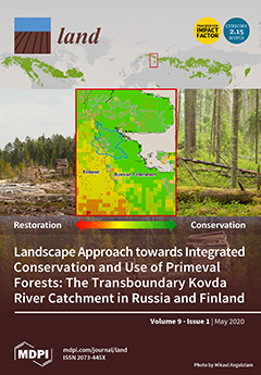
This paper presents the results of 39 years of observations conducted at the Chabyda station to monitor the thermal state of permafrost landscapes under current climatic warming. The analysis of long-term records from weather stations in the region has revealed one of the highest increasing trends in mean annual air temperature in northern Russia. The partitioning of the energy balance in different landscape units within the study area has been analyzed.

Monitoring of Changes in Land Use/Land Cover in Syria from 2010 to 2018 Using Multitemporal Landsat Imagery and GIS

Peer-reviewed publication
July, 2020
Syrian Arab Republic

Understanding the effects of socio-ecological shocks on land use/land cover (LULC) change is essential for developing land management strategies and for reducing adverse environmental pressures. Our study examines the impacts of the armed conflict in Syria, which began in mid-2011, and the related social and economic crisis on LULC between 2010 and 2018. We used remote sensing for change detection by applying a supervised maximum likelihood classification to Landsat images of the three target years 2010, 2014, and 2018.

Performance of the Remotely-Derived Products in Monitoring Gross Primary Production across Arid and Semi-Arid Ecosystems in Northwest China

Peer-reviewed publication
September, 2020
China
Russia
United States of America

As an important component to quantify the carbon budget, accurate evaluation of terrestrial gross primary production (GPP) is crucial for large-scale applications, especially in dryland ecosystems. Based on the in situ data from six flux sites in northwestern China from 2014 to 2016, this study compares seasonal and interannual dynamics of carbon fluxes between these arid and semi-arid ecosystems and the atmosphere.

Global Open Data Remote Sensing Satellite Missions for Land Monitoring and Conservation: A Review

Peer-reviewed publication
October, 2020
Global

The application of global open data remote sensing satellite missions in land monitoring and conservation studies is in the state of rapid growth, ensuring an observation with high spatial and spectral resolution over large areas. The purpose of this study was to provide a review of the most important global open data remote sensing satellite missions, current state-of-the-art processing methods and applications in land monitoring and conservation studies.

Establishment of Permafrost Thermal Monitoring Sites in East Siberia

Peer-reviewed publication
December, 2020
United States of America

Permafrost lies close to the surface of the day, therefore, it is able to quickly respond to modern climatic changes. Under these conditions, the goal of understanding the evolution of permafrost in the near future requires monitoring studies of the current state of permafrost and, first of all, its thermal conditions.

Groundthruthing: A note on methodology

Manuals & Guidelines
May, 2016
Global

This guide aims to help community organisers and paralegals to use the method of “ground-truthing” to collect information about operations that might be illegal, prohibited or causing harm. It is a useful tool to monitor the impacts of investments and the proper implementation of agreements and contracts.

This resource is part of the CCSI’s Directory of Community Guidance on Agreements Relating to Agriculture or Forestry Investment.