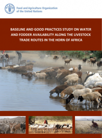
Water and fodder availability along livestock trade routes in the Horn of Africa
Reports & Research
June, 2017
Africa
AGROVOC URI: http://aims.fao.org/aos/agrovoc/c_6448
Pastoralism is a livelihood strategy and a system of mobile livestock production that makes wide-ranging use of grazing lands in arid and semi-arid environment that doesn’t uphold sustainable crop cultivation. The freedom of mobility over outsized land for seasonal pastures is indispensable to pastoralist production primarily in order to convert the pastures residues into human food. The people and livestock in pastoral communities may move to avoid various natural and/or social hazards, to avert competition with others, or to seek more favourable conditions.

The goal of the Rangelands Initiative is increased tenure security of local rangeland users through improved implementation of enabling policy and legislation. By connecting, mobilising and influencing, the Initiative strengthens ILC members’ activities in-country and across its continental platforms.

Extensive grazing is the predominant form of land use on at least a quarter of the world’s land surface, in which livestock are raised on food that comes mainly from rangelands. The term livestock includes both domesticated animals such as cattle, sheep, goats, camels, horses, llamas and alpacas, and a broad range of wild animals kept for meat or game viewing. It is estimated that tropical grasslands alone cover 18 million square kilometres, where the natural vegetation is used by mobile animals requiring forage and water throughout the year.
Participatory digital mapping using satellite imagery and digital earth and other open source Geographic Information Systems (GIS) is a practical tool bridging the knowledge and communication gap between pastoral communities and county government planners. It is offering an effective option for participatory planning and decision-making in support of climate change adaptation in the drylands of Kenya.
Introduction: Water as a range management tool The pastoral system - the inter-relationship between livestock, natural resources and people / institutions - has evolved to function effectively and efficiently in areas of low and unpredictable rainfall, using mobility as one of the key adaptation strategies. Although having undergone changes over the years, the pastoralist system comprises fundamental elements which have allowed it to persist for millennia.
This Practitioners’ Guide provides the step-by-step instructions and checklists that will guide a mapping team through a mapping exercise.
A Field Manual to support planning and management in rangelands including in Village Land Use Planning

Mwongozo wa Uwandani wa kusaidia Kupanga Mpango na Usimamizi wa Nyanda za Malisho ikiwemo kupanga Mpango wa Matumizi Bora ya Ardhi ya Kijiji
This issue paper No. 6 of the Rangelands Series consolidates a set of case studies which document how pastoralists plan land and resource use in pastoral and agro-pastoral areas of Ethiopia.

No.7 issue of the Rangelands Series goes through experiences of joint village land use agreements and planning.

The delineation and protection of transhumance corridors are increasingly seen as critical to maintaining livestock mobility in agropastoral areas of West Africa by allowing passage through areas of increasing cropping pressure. Understanding the local politics surrounding the mapping and protection of transhumance corridors is important for policy formulation. This study reports the findings of group meetings in nine local districts (communautés rurales) in eastern Senegal about recently mapped corridors.