
page search

Issuescadastral registerLandLibrary Resource
There are 240 content items of different types and languages related to cadastral register on the Land Portal.
Displaying 37 - 48 of 63

The Global Programme Responsible Land Policy (GPRLP)

Institutional & promotional materials
August, 2019
Global

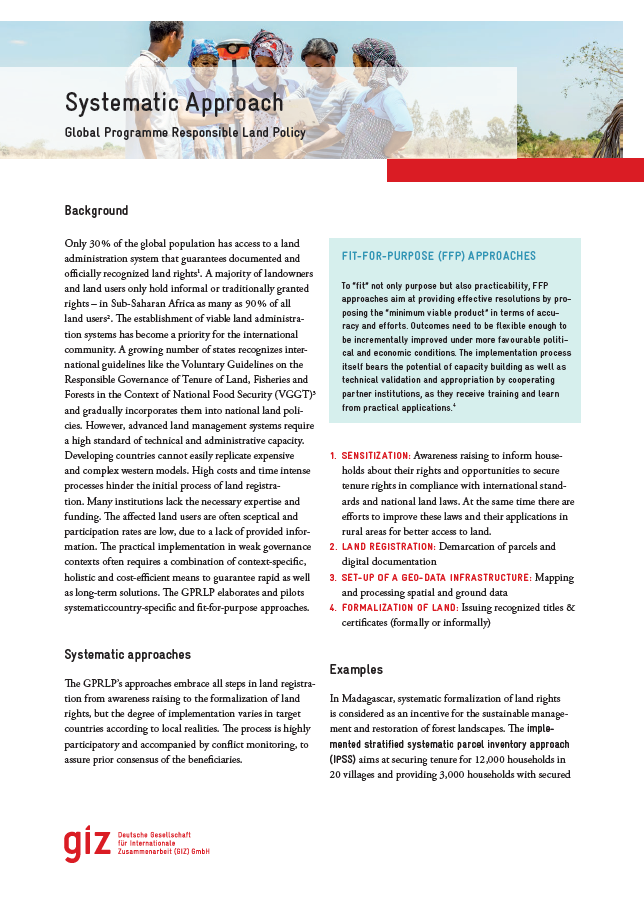
This brochure presents the approach and core activities of GIZ Global Program on Responsible Land Policy (GPRLP). The GPRLP is active in Benin, Ethiopia, Laos, Madagascar, Paraguay, Peru and Uganda. In each country, a context specific approach in line with the global GPRLP concept aims at improving the access to land as a core condition for combating poverty and hunger in rural areas for specific population groups, particularly women and socially marginalised groups.

Field Reseach and Desk Study Report

Reports & Research
June, 2017
Sub-Saharan Africa
Uganda

Teso Initiative for Peace (TIP) received funds from the German Federal Ministry for Economic Cooperation and Development (BMZ) that has been delegated through Deutsche Gesellschaft für Internationale Zusammenarbeit (GIZ) under a project titled “Responsible Land Policy in Uganda” (RELAPU). In its pursuit to reduce extreme poverty and hunger in the world under its Field of Action 6 i.e.

After 200 Years, Why is Indonesia's Cadastral System Still Incomplete?

Policy Papers & Briefs
January, 2016
Indonesia

This paper discusses Indonesia’s experience with establishing a uniform cadastral system in rural areas since the idea was first mooted in the early 19th century. Until 1961, a formal cadastre that identified, measured, registered and certified land titles existed only in urban areas. A cadastre for rural land did not start until after the 1960 Agrarian Law. Until then, the village-based land tax registers acted as a substitute cadastral register in areas subject to land tax.

Malaysian Land Administration Domain Model Country Profile

Peer-reviewed publication
July, 2015
Malaysia

Land administration is a process of recording and disseminating information about the association between people and land. To administer land matters in Malaysia, the Department of Surveying and Mapping Malaysia uses eKadaster and Land Office has eTanah which are different in e-Systems. Currently, Malaysia does not have a standard model for land administration and standardisation is one of the important aspects in a land administration process. This paper proposed a country profile model using international standards based on Land Administration Domain Model.

Legal Coordinated Cadastres

Conference Papers & Reports
September, 2006
Singapore

The field of cadastre holds an inherent complexity much based on its interdisciplinary characteristics and the national uniqueness of each cadastral system. In addition, some cadastral terminology is vague or ambiguous, which is why omission of the explicit sense and context of a particular term may bring obscurity to international comparisons and analyses. The concept legal coordinated cadastre (and kindred expressions), occasionally mentioned in connection with visions and plans of cadastral modernisation, is discussed here in order to clarify possible meanings and implications.

Land Administration System In Pakistan – Current Situation And Stakeholders’ Perception

Conference Papers & Reports
March, 2010
Pakistan

The current land administration system in Pakistan aims at land revenue assessment and tax collection for the fiscal purposes. This system is organised or structured on the traditional land registers and cadastral maps in paper formats, and their maintenance is mainly dependent on the hard works of the local land administrator so called “Patwari” at the grass-root level within his jurisdiction.

Understanding information about agricultural land. An evaluation of the extent of data modification in the Land Parcel Identification System for the needs of area-based payments – a case study

Peer-reviewed publication
April, 2020
Poland
United States of America

The development the GIS technology and growing access to spatial data encourage greater use of information for various purposes. Users may not be aware that data pertaining to the same fragment of land (in aspect of geometry or description attributes), but acquired from different sources do not always adequately reflect reality. After Poland's accession to the European Union, the EU Member States have undertaken to develop a Land Parcel Identification System (LPIS) as part of the Integrated Administration and Control System in every country.

A proposition to solve the land cadaster system in Brazil: the role of CNIR and a new institutionalization

Conference Papers & Reports
February, 2016
Latin America and the Caribbean
South America
Brazil

Brazil has, on the one hand, strong institutions in various areas, improved social situation and, on the other, the rural land situation is still very precarious, with basic unresolved questions, such as for example, knowledge of what is public and private land, due to the absence of cadaster. The legislation moved forward in an attempt to link the cadasters of INCRA, the Internal Revenue Service, with information from the Registry of Real Estate with the enactment of Law No. 10,267 / 2001, creating the National Register of Rural Properties – CNIR.

The role of open data in fighting land corruption

Reports & Research
December, 2020
Global

The rapid progress in digital information and communication technologies  (ICTs) comes with both fresh opportunities and new challenges for different sectors and actors adopting the new solutions that become available over time. Since the mid-2000s, the global land governance community has piloted a series of open data and transparency initiatives largely based on such digital innovations, aiming at increasing accountability and counteracting corruption in the land sector, both at the local and global level.

The Role of Open Data in the Fight against Land Corruption

Reports & Research
February, 2021
Global

Opening up land-related administrative data, combining it with data from other sources  and processing and making this data available as easily accessible information for women and men equally could be a means to counteracting land corruption in land management, land administration and land allocation. But does open data and enhanced data transparency indeed help to counteract land corruption?