Pasar al contenido principal

page search

There are 9, 789 content items of different types and languages related to Utilización de la tierra on the Land Portal.
Displaying 3313 - 3324 of 4572

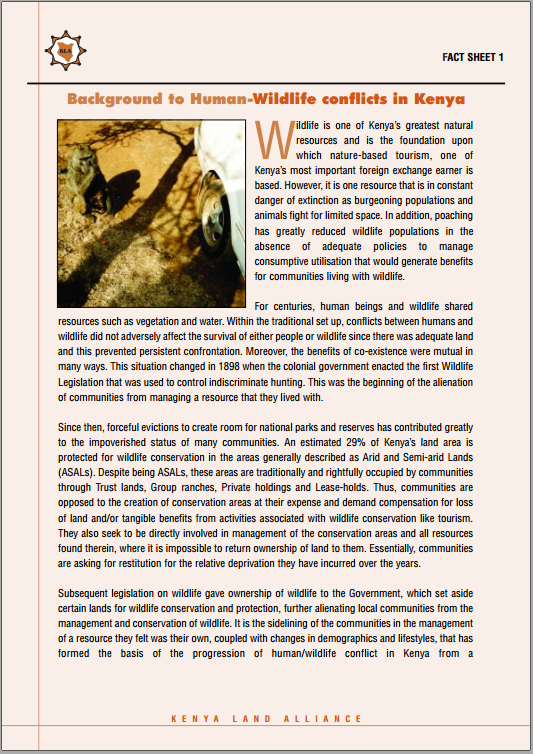
Background to Human-Wildlife conflicts in Kenya

Policy Papers & Briefs
Febrero, 2012
Kenya

Wildlife is one of Kenya’s greatest natural resource and is the foundation upon which nature-based tourism is based. However, it is one resource that is in constant danger of extinction as burgeoning populations and animals fight for limited space In addition, poaching has greatly reduced wildlife populations in the absence of adequate policies to manage consumptive utilisation that would generate benefits for communities living with wildlife.

WOMEN TO KILIMANJARO: STAND UP FOR WOMEN LAND RIGHTS

Policy Papers & Briefs
Marzo, 2017
Kenya

The Kilimanjaro Initiative is a rural women’s mobilisation from across Africa towards an iconic moment at the foot of Mt Kilimanjaro in October 2016. The Kilimanjaro Initiative was conceived by the Rural Women during a meeting of rural women and civil society organisations in 2012, held in Dar es Salaam, Tanzania. This initiative aims to create space for us as rural women to be able to participate in decision making processes about land and natural resources.

The Draft National Land Policy: A Step towards Land Reforms

Policy Papers & Briefs
Enero, 2007
Kenya

Through this Land Update, KLA appreciates that for the first time in the history of Kenya a comprehensive Draft National Land Policy has been formulated.We therefore urge all Kenyans and the general public to read, debate and contribute to the finalization of the National Land Policy. This is because the final National Land Policy will provide the basis for the review and harmonization of the existing laws and enacting of new ones to facilitate the achievement of the objectives set out in the overall national development policy framework, Kenya Vision 2030

Land, Environment and Natural Resources Submission to the Constitution of Kenya Review Commission From Kenya Land Alliance

Journal Articles & Books
Junio, 2002
Kenya

The Kenya Land Alliance (KLA) is a focal point for information sharing and networking among those pressing for land reform in Kenya. It was formed in 1999 by members of civil society to propose reforms both to the Commission on the Review of Land Laws, appointed by the President, and the Constitution of Kenya Review Commission, appointed by Parliament. Over the last two years, the KLA has coordinated a programme of research on land issues in Kenya by member organisations

Community Land Tenure and the Management of Community Land in Kenya

Policy Papers & Briefs
Diciembre, 2007
Kenya

A majority of the Kenyan population live in rural areas accessing land and natural resources through customary systems and institutions that operate largely outside the mainstream legal framework of land administration. Although there are clear provisions in the Constitution and the Trust Land Act on management of trust land there appears to be an unwritten policy on the part of government that sees community land as land that is not owned but rather is available for County Councils and government to appropriate through the setting apart procedure

Land Mali Umma

Journal Articles & Books
Septiembre, 2001
Kenya

For a long time the issue of land and related problems has been debated mostly by academicians, politicians and professionals. Although the problem has remained more or less one of the most talked of in Kenya, the public has very often been left out of the debate. Again mostly the debate has been dominated more by complaining about either the lack of policy or the bad land policies and laws and the failure by successive governments to correct those problems.

Aboveground Biomass Distribution in a Multi-Use Savannah Landscape in Southeastern Kenya: Impact of Land Use and Fences

Peer-reviewed publication
Septiembre, 2020
Kenya
Noruega

Savannahs provide valuable ecosystem services and contribute to continental and global carbon budgets. In addition, savannahs exhibit multiple land uses, e.g., wildlife conservation, pastoralism, and crop farming. Despite their importance, the effect of land use on woody aboveground biomass (AGB) in savannahs is understudied. Furthermore, fences used to reduce human–wildlife conflicts may affect AGB patterns. We assessed AGB densities and patterns, and the effect of land use and fences on AGB in a multi-use savannah landscape in southeastern Kenya.

Global and Local Modeling of Land Use Change in the Border Cities of Laredo, Texas, USA and Nuevo Laredo, Tamaulipas, Mexico: A Comparative Analysis

Peer-reviewed publication
Septiembre, 2020
México
Estados Unidos de América
Noruega
España
Global

This paper estimates global logistic regression and logistic geographically weighted regression (GWR) models of urban growth in the adjacent border cities of Laredo, Texas in the United States and Nuevo Laredo, Tamaulipas in Mexico, for two time periods from 1985 to 2014. Historical land use and land cover patterns were monitored through Landsat imagery from the United States Geological Survey to identify instances of urban growth through land type change. Data on socioeconomic variables related to urban growth were collected from various sources and used as independent variables.

Towards a Walkable City: Principal Component Analysis for Defining Sub-Centralities in the Santiago Metropolitan Area

Peer-reviewed publication
Septiembre, 2020
Chile

This article presents a methodology for evaluating the potential for an urban area to become a 15-min city based on its existing essential urban functions. To elaborate this methodology, the research focused on the Metropolitan Area of Santiago de Chile, by identifying 28 urban functions and applying principal component analysis to review how these georeferenced variables are grouped into synthetic components that illustrate the walkability of each block concerning access to these functions.

Urbanization and Increasing Flood Risk in the Northern Coast of Central Java—Indonesia: An Assessment towards Better Land Use Policy and Flood Management

Peer-reviewed publication
Septiembre, 2020
Indonesia

This study explores urbanization and flood events in the northern coast of Central Java with river basin as its unit of analysis. Two types of analysis were applied (i.e., spatial data and non-spatial data analysis) at four river basin areas in Central Java—Indonesia. The spatial analysis is focused on the assessment of LULC change in 2009–2018 based on Landsat Imagery. The non-spatial data (i.e., rural-urban classification and flood events) were overlaid with results of spatial data analyses.

Land Use/Land Cover Changes and the Relationship with Land Surface Temperature Using Landsat and MODIS Imageries in Cameron Highlands, Malaysia

Peer-reviewed publication
Septiembre, 2020
Estados Unidos de América
Malasia
Noruega

Mountainous regions are more sensitive to climatic condition changes and are susceptible to recent increases in temperature. Due to urbanization and land use/land cover (LULC) issues, Cameron Highlands has been impacted by rising land surface temperature (LST) variation. Thus, this study was carried out to explore the impact of the LULC change on LST in the Cameron Highlands from 2009 to 2019 using remote sensing images acquired from Landsat 7 ETM+, Landsat 8 Operational Land Imager (OLI/TIRS), and Moderate Resolution Imaging Spectroradiometer (MODIS) 11A Thermal sensors.