Land Library
Welcome to the Land Portal Library. Explore our vast collection of open-access resources (over 74,000) including reports, journal articles, research papers, peer-reviewed publications, legal documents, videos and much more.
/ library resources
Showing items 1 through 9 of 202.Accurate estimates of habitat extent and rates of change are crucial inputs for the global, regional, and national assessments that guide policy-making and prioritize strategies. This can contribute to an understanding of ecosystems in the landscape for their use, management, and preservation.
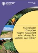
The Maghreb's oases systems provide a major contribution to the region's food security, economy and natural resources. Despite this potential, oasis ecosystems are threatened by a range of complex factors related to the expansion of agricultural land and increasing scarcity of water resources.
Geospatial datasets and analysis techniques based on geographic information systems (GIS) have become indispensable tools in the planning, implementation and evaluation of a wide range of development programmes, including actions addressing sustainable agriculture and rural development.
This eco-type map presents land units with distinct vegetation and exposure to floods (or droughts) in three villages in the Barotseland, Zambia.
Challabamba en Cusco y Quilcas en Huancayo son dos zonas contrastantes con alta biodiversidad de variedades de papa. El presente estudio tuvo por finalidad evaluar la distribución espacial de la biodiversidad de papa mediante el mapeo participativo.
As solar panels become more a ordable, solar photovoltaic (PV) pumps have been identi ed as a high potential water lifting technology to meet the growing irrigation demand in sub-Saharan Africa (SSA).
Este manual tiene como objetivo familiarizar a los usuarios de la herramienta FAO-ASIS País con la conversión de datos del Sistema de Información Geográfica (SIG) a los formatos adecuados para alimentar la herramienta.
OPEN FORIS Y SEPAL (Sistema de acceso de datos de observación de la tierra, procesamiento y análisis para el monitoreo de la superficie terrestre)
In the Gash Delta of Eastern Sudan, spate irrigation (flood-recession farming) contributes substantially to rural livelihoods by providing better yields than rainfed dryland farming. However, spate irrigation farmers are challenged by the unpredictability of flooding.


