Species Distribution Modeling with Remote Sensing
Species Distribution Models (SDMs) play a critical role in biodiversity, conservation, and understanding the potential impacts to ecosystems under changing climate conditions. SDMs contextualize future scenarios based on known or projected ecological parameters and are the cornerstone for adaptive management planning around short- and long-term changes to complex landscapes.
Conférence Intensification Durable 2021
3ème édition de la Conférence Intensification Durable 2021, Dakar :
ADAPTATION ET RESILIENCE DES AGRICULTURES EN AFRIQUE DE L’OUEST : INNOVATIONS AGROECOLOGIQUES ET INTEGRATION DES TERRITOIRES
LANDac Conference 2021
The LANDac Annual International Conference offers a podium for knowledge exchange between researchers, practitioners and private sector representatives interested in land governance for equitable and sustainable development
LAND-at-scale Knowledge Management Launch
Knowledge management and learning is at the heart of the LAND-at-scale program. For this reason, RVO is excited to announce a partnership with LANDac and the International Land Coalition for the implementation of an integrated knowledge management component as part of the program.
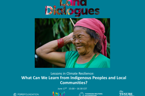
Lessons in Climate Resilience: What Can We Learn from Indigenous Peoples and Local Communities?
Indigenous Peoples globally have high exposure to environmental change and are often considered an ‘‘at-risk’’ population, although there is growing evidence of their resilience. Ample research illustrates that Indigenous Peoples are actively observing and adapting to change in a diversity of ways. In this webinar we examined the common factor affecting resilience to environmental change among Indigenous Peoples and local communities.
NASA Earth Observations for Energy Management
Energy impacts everything we do, from providing basic services such as cooking and cleaning to providing development opportunities and improving overall quality of life. However, energy management, through energy production, transmission, and distribution, is impacted by environmental and climate conditions, including weather patterns or extremes and climate change.
Introduction to Population Grids and their Integration with Remote Sensing Data for Sustainable Development and Disaster Management
NASA’s Applied Remote Sensing Training Program, ARSET has opened a new open, online webinar series: Introduction to Population Grids and their Integration with Remote Sensing Data for Sustainable Development and Disaster Management
Use of Solar Induced Fluorescence and LIDAR to Assess Vegetation Change and Vulnerability
This introductory webinar series will cover the fundamentals of Solar Induced Fluorescence (SIF) and LIDAR, their applications, and an overview of different satellite data sources that are openly available. In addition, it will also include a step-by-step guide on how to access, open, and interpret SIF and LIDAR data.
Mapping and Monitoring Lakes and Reservoirs with Satellite Observations
Natural lakes and man-made reservoirs are a part of Earth’s surface water. Freshwater lakes and reservoirs are used for drinking water, fishing, and recreational activities. Aside from the aesthetic and scenic value added by their presence, lakes support surrounding plant and aquatic ecosystems and wildlife.
Land Dialogues Webinar Series
The Land Portal Foundation, the Tenure Facility, the Thomson Reuters Foundation and the Ford Foundation proposed a series of Land Dialogues promoting the centrality of Indigenous and community land rights in advancing global efforts to halt the climate crisis, achieving a healthy planet and forwarding the 2030 Agenda for Sustainable Development.


