Resources
Displaying 1981 - 1985 of 2258Informal Urban Green Space: Residents’ Perception, Use, and Management Preferences across Four Major Japanese Shrinking Cities
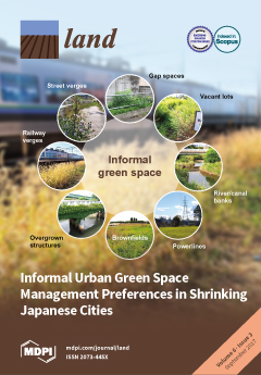
Urban residents’ health depends on green infrastructure to cope with climate change. Shrinking cities could utilize vacant land to provide more green space, but declining tax revenues preclude new park development—a situation pronounced in Japan, where some cities are projected to shrink by over ten percent, but lack green space. Could informal urban green spaces (IGS; vacant lots, street verges, brownfields etc.) supplement parks in shrinking cities?
High-Resolution Vegetation Mapping in Japan by Combining Sentinel-2 and Landsat 8 Based Multi-Temporal Datasets through Machine Learning and Cross-Validation Approach
This paper presents an evaluation of the multi-source satellite datasets such as Sentinel-2, Landsat-8, and Moderate Resolution Imaging Spectroradiometer (MODIS) with different spatial and temporal resolutions for nationwide vegetation mapping. The random forests based machine learning and cross-validation approach was applied for evaluating the performance of different datasets.
Soy Expansion and Socioeconomic Development in Municipalities of Brazil
Soy occupies the largest area of agricultural land in Brazil, spreading from southern states to the Amazon region. Soy is also the most important agricultural commodity among Brazilian exports affecting food security and land use nationally and internationally. Here we pose the question of whether soy expansion affects only economic growth or whether it also boosts socioeconomic development, fostering education and health improvements in Brazilian municipalities where it is planted.
Vegetation in Drylands: Effects on Wind Flow and Aeolian Sediment Transport
Drylands are characterised by patchy vegetation, erodible surfaces and erosive aeolian processes. Empirical and modelling studies have shown that vegetation elements provide drag on the overlying airflow, thus affecting wind velocity profiles and altering erosive dynamics on desert surfaces. However, these dynamics are significantly complicated by a variety of factors, including turbulence, and vegetation porosity and pliability effects. This has resulted in some uncertainty about the effect of vegetation on sediment transport in drylands.
The Integration of Ecosystem Services in Planning: An Evaluation of the Nutrient Retention Model Using InVEST Software
Mapping ecosystem services (ES) increases the awareness of natural capital value, leading to building sustainability into decision-making processes. Recently, many techniques to assess the value of ES delivered by different scenarios of land use/land cover (LULC) are available, thus becoming important practices in mapping to support the land use planning process. The spatial analysis of the biophysical ES distribution allows a better comprehension of the environmental and social implications of planning, especially when ES concerns the management of risk (e.g., erosion, pollution).