Aller au contenu principal

page search

Issuesutilisation des terresLandLibrary Resource
There are 9, 789 content items of different types and languages related to utilisation des terres on the Land Portal.
Displaying 3253 - 3264 of 4598

Constraining the Deforestation History of Europe: Evaluation of Historical Land Use Scenarios with Pollen-Based Land Cover Reconstructions

Peer-reviewed publication
Décembre, 2017
Europe

Anthropogenic land cover change (ALCC) is the most important transformation of the Earth system that occurred in the preindustrial Holocene, with implications for carbon, water and sediment cycles, biodiversity and the provision of ecosystem services and regional and global climate. For example, anthropogenic deforestation in preindustrial Eurasia may have led to feedbacks to the climate system: both biogeophysical, regionally amplifying winter cold and summer warm temperatures, and biogeochemical, stabilizing atmospheric CO 2 concentrations and thus influencing global climate.

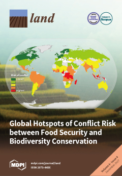
Global Hotspots of Conflict Risk between Food Security and Biodiversity Conservation

Peer-reviewed publication
Décembre, 2017
Madagascar

The global challenges of food security and biodiversity are rarely addressed together, though recently there has been an increasing awareness that the two issues are closely related. The majority of land available for agriculture is already used for food production, but despite the productivity gains, one in nine people worldwide are classified as food insecure. There is an increasing risk that addressing food insecurity through methods such as agricultural expansion or intensification could lead to biodiversity loss through destruction of habitats important for conservation.

Agricultural Land Use Change after NAFTA in Central West Mexico

Peer-reviewed publication
Décembre, 2017
Mexique

It has been suggested that agricultural land use change and modernization in agricultural production techniques are related to the loss of crop diversity. Two processes contribute to this loss; first is the replacement of landraces by modern varieties, and second is the abandonment of traditional crops in favor of cash crops. We studied the expression of these processes in a region that is both an agro-biodiversity and cultural center and one of the most significant fruit exporters of Mexico.

Effect of Climate and Agricultural Land Use Changes on UK Feed Barley Production and Food Security to the 2050s

Peer-reviewed publication
Décembre, 2017
Global

Currently, the UK has a high self-sufficiency rate in barley production. This paper assessed the effects of projected climate and land use changes on feed barley production and, consequently, on meat supply in the UK from the 2030s to the 2050s. Total barley production under projected land use and climate changes ranged from 4.6 million tons in the 2030s to 9.0 million tons in the 2050s. From these, the projected feed barley supply ranged from approximately 2.3 to 4.6 million tons from the 2030s to the 2050s, respectively.

Modeling Land Use and Land Cover Changes and Their Effects on Biodiversity in Central Kalimantan, Indonesia

Peer-reviewed publication
Juin, 2018
Indonésie

Land use and land cover (LULC) change causes biodiversity decline through loss, alteration, and fragmentation of habitats. There are uncertainties on how LULC will change in the future and the effect of such change on biodiversity. In this paper we applied the Land Change Modeler (LCM) and Integrated Valuation of Ecosystem Services and Tradeoffs (InVEST) Scenario Generator tool to develop three spatially explicit LULC future scenarios from 2015 to 2030 in the Pulang Pisau district of Central Kalimantan, Indonesia.

Land Use Scenario Modeling Based on Local Knowledge for the Provision of Ecosystem Services in Northern Ghana

Peer-reviewed publication
Juin, 2018
Afrique occidentale

The understanding of multiple effects by possible future development is essential for adapted land use planning. This study assessed the potential of land use scenarios for the provision of ecosystem services using local knowledge in two districts of northern Ghana. Local knowledge was gathered through surveys with extension officers, who are regarded as eligible knowledge holders for agricultural land use.

Land Acquisition in India: A Pareto and Kaldor-Hicks Perspective

Peer-reviewed publication
Juin, 2018
Inde

Land acquisition by the government or a private entity to aid industrialization remains a critical policy concern. In 2013, The Right to Fair Compensation and Transparency in Land Acquisition, Rehabilitation and Resettlement Act (LARR Act of 2013) became the premier land law in India. The Act creates a transparent process through which buyers can acquire land for industrialization and other commercial activities. However, the succeeding government was dissatisfied with some provisions in the original Act and floated two Amendment Bills in 2014 and 2015.

The Fractal Geometry of Urban Land Use: The Case of Ulaanbaatar City, Mongolia

Peer-reviewed publication
Juin, 2018
Mongolie

This research summarizes land use and city expansion, as well as the dynamics of urbanization, over recent years in Ulaanbaatar city, Mongolia. The study applies fractal geometry to describe land uses in Ulaanbaatar city using a mathematical procedure and geographic information system (GIS) urban analysis, and measures urban sprawl using an index relation of area and perimeter. Land-use parcels’ shape, area perimeter relations, sprawl statement and geometry of city structure are considered. The research presents the growth of Ulaanbaatar city in two time series, 2000 and 2010.

Improving the Matrix-Assessment of Ecosystem Services Provision—The Case of Regional Land Use Planning under Climate Change in the Region of Halle, Germany

Peer-reviewed publication
Juin, 2018
Allemagne

Against the background of climate change, current and future provision of ecosystem services (ES) will also change. The recording of current provision potentials and its development in future is important for adapted regional planning. ES assessments are frequently carried out in the context of expert-based surveys, which have, however, revealed little information to date about uncertainties. We present a novel approach that combines the ES matrix assessment with the Delphi approach, confidence ratings, standardized confidence levels, and scenario assessment.

Interactions between Food Security and Land Use in the Context of Global Change

Peer-reviewed publication
Juin, 2018
Global

Increases in human population and per-capita consumption are putting enormous pressure on land resources. About 38% of the Earth’s land area is being used in agricultural production [1], with about half (ca. 31%) of the remaining land being under forest cover [2] and the other half being less suitable for agricultural production due to edaphic, topographic and/or climatic factors. Despite the fact that over the last three decades the world food production has doubled [3], about 1 in 9 people in the world is still undernourished [4].

An Experimental Framework for Integrating Citizen and Community Science into Land Cover, Land Use, and Land Change Detection Processes in a National Mapping Agency

Peer-reviewed publication
Septembre, 2018
France

Accurate and up-to-date information on land use and land cover (LULC) is needed to develop policies on reducing soil sealing through increased urbanization as well as to meet climate targets. More detailed information about building function is also required but is currently lacking.

Analyses of Land Cover Change Trajectories Leading to Tropical Forest Loss: Illustrated for the West Kutai and Mahakam Ulu Districts, East Kalimantan, Indonesia

Peer-reviewed publication
Septembre, 2018
Indonésie

In Indonesia, land cover change for agriculture and mining is threatening tropical forests, biodiversity and ecosystem services. However, land cover change is highly dynamic and complex and varies over time and space. In this study, we combined Landsat-based land cover (change) mapping, pixel-to-pixel cross tabulations and expert knowledge to analyze land cover change and forest loss in the West Kutai and Mahakam Ulu districts in East Kalimantan from 1990–2009.