Pasar al contenido principal

page search

There are 1, 594 content items of different types and languages related to Uso sostenible de la tierra on the Land Portal.
Displaying 301 - 312 of 707

Atlas des Produits des Zones Arides d'Afrique

Manuals & Guidelines
Diciembre, 2008
África

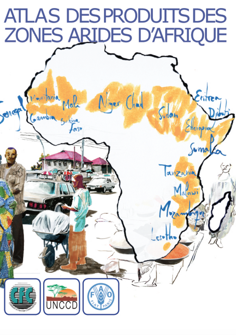
Avant-propos La notion de désertification se définit comme une dégradation des sols en zone aride, semi-aride et subhumide sèche, souvent appelée simplement « zone aride ». On estime qu’elle résulte d’une combinaison de facteurs, parmi lesquels les changements climatiques et l’activité humaine. Plus d’un tiers de la superficie totale de la terre est considéré comme zone aride. En termes démographiques, c’est un cinquième de la population totale du globe qui vit en zone aride déjà dégradée ou menacée de désertification.

Participatory rangeland resource mapping as a valuable tool for village land use planning in Tanzania

Policy Papers & Briefs
Enero, 2012
Tanzania

This Issue Paper No.2 is part of the series Making Rangelands Secure, a learning initiative supported by ILC, IFAD, RECONCILE, IUCN-WISP and Procasur. The Making Rangelands Secure Initiative has been established by a group of organisations seeking to improve security of rights to rangelands. The initiative seeks to identify, communicate and build good practice on making rangelands secure for local rangeland users.


Land and Water Grabbing

Policy Papers & Briefs
Marzo, 2018
Global

IN’s latest resource is an introduction to the topic Land and Water Grabbing: A discussion of integrity implications and related risks, which discusses the integrity implications and risks of land and water grabbing. The essay examines the link between land and water grabbing, the people that are most impacted by this, and legal frameworks related to both land and water rights. Land and Water Grabbing describes the impacts of land and water grabbing in Kenya and Ethiopia.

Plantation Development in the Turkana Basin: The Making of a New Desert?

Peer-reviewed publication

Since the early 20th century, “desert reclamation” has been synonymous with large-scale waterworks and irrigation. These techniques have made it possible to produce abundant crops in arid or semi-arid environments. The costs have often been externalized, with increased environmental productivity in the new croplands counterbalanced by increased aridity elsewhere. In this paper I consider whose interests are served by such projects, and what kinds of social constructions of the natural and human environment make them possible.

A Regional Perspective on Urbanization and Climate-Related Disasters in the Northern Coastal Region of Central Java, Indonesia

Peer-reviewed publication

Indonesia, as an archipelagic nation, has about 150 million people (60%) living in coastal areas. Such communities are increasingly vulnerable to the effects of change, in the form of sea level rise and stronger, more intense storms. Population growth in coastal areas will also increase the disaster risk mainly because of climate change-related effects such as flooding, droughts, and tidal floods. This study examines the dynamic changes of urban population and urban villages in three decadal periods, from 1990, 2000, to 2010.

Berenty Reserve—A Gallery Forest in Decline in Dry Southern Madagascar—Towards Forest Restoration

Peer-reviewed publication

Berenty Reserve, a fully protected gallery forest beside the Mandrare River is renowned for its lemurs, but the continuous canopy of the main forest is shrinking, fragmenting and degrading. The aim of this study, before any restoration can be considered, is to investigate why canopy-cover is declining and define the forest’s vegetation status and composition. Our study includes analysis of tamarind age (the dominant species) and regeneration, forest extent, climate and soil.

Monitoring and Analysing Land Use/Cover Changes in an Arid Region Based on Multi-Satellite Data: The Kashgar Region, Northwest China

Peer-reviewed publication

In arid regions, oases ecosystems are fragile and sensitive to climate change, and water is the major limiting factor for environmental and socio-economic developments. Understanding the drivers of land use/cover change (LUCC) in arid regions is important for the development of management strategies to improve or prevent environmental deterioration and loss of natural resources.

Spatial Modeling of Soil Erosion Risk and Its Implication for Conservation Planning: the Case of the Gobele Watershed, East Hararghe Zone, Ethiopia

Peer-reviewed publication

Soil erosion by water has accelerated over recent decades due to non-sustainable land use practices resulting in substantial land degradation processes. Spatially explicit information on soil erosion is critical for the development and implementation of appropriate Soil and Water Conservation (SWC) measures.The objectives of this study were to estimate the magnitude of soil loss rate, assess the change of erosion risk, and elucidate their implication for SWC planning in the Gobele Watershed, East Hararghe Zone, Ethiopia.

Dawna Tenasserim Landscape (WWF leaflet)

Reports & Research
Febrero, 2014
Myanmar

...The forests of the Dawna Tenasserim are under pressure from deforestation due to
agricultural expansion and logging, forest fragmentation, subsistence poaching, commercial
poaching for the illegal wildlife trade, unsustainable harvesting of non-timber forest products
and wild meat, and major infrastructure development such as roads, pipelines and dams...WWF is conserving the Dawna Tenasserim Landscape
as an intact ecosystem with protected and connected
habitats for wildlife, and safeguarding its valuable

Ice melt, sea level rise and superstorms: evidence from paleoclimate data, climate modeling, and modern observations that 2 °C global warming could be dangerous

Reports & Research
Marzo, 2016
Myanmar

Abstract. "We use numerical climate simulations, paleoclimate data, and modern observations to study the effect of growing ice melt from Antarctica and Greenland. Meltwater tends to stabilize the ocean column, inducing amplifying feedbacks that increase subsurface ocean warming and ice shelf melting. Cold meltwater and induced dynamical effects cause ocean surface cooling in the Southern Ocean and North Atlantic, thus increasing Earth's energy imbalance and heat flux into most of the global ocean's surface.

Grave Diggers: A report on Mining in Burma

Policy Papers & Briefs
Febrero, 2000
Myanmar

A report on mining in Burma. The problems mining is bringing to the Burmese people, and the multinational companies involved in it. Includes an analysis of the SLORC 1994 Mining Law.... 'Grave Diggers, authored by world renowned mining environmental activist Roger Moody, was the first major review of mining in Burma since the country's military regime opened the door to foreign mining investment in 1994.

Burma one of countries most affected by climate change

Reports & Research
Junio, 2015
Myanmar

Burma has been ranked by a German think tank as the second worst country with regards to the effects of climate change between 1994 and 2013.

The Global Climate Risk Index 2015, published by Germanwatch, listed Honduras as the country suffering most from the effects of extreme weather events in the 20-year period. Burma’s neighbours Bangladesh, Vietnam and Thailand were ranked as fourth, sixth and ninth worst affected, respectively.