Utilización de la tierra
AGROVOC URI:
A study on land use types, soils and linkage between soils and biodiversity along the slopes of Mt. Kilimanjaro, Tanzania
Abundance and diversity of soil mites (Acari) along a gradient of land use types in Taita Taveta, Kenya
The abundance and diversity of soil mites was monitored along a gradient of land use types (LUTs) during the wet seasons in soils of Taita Taveta, Kenya. Sampling of mites from soils was carried out in eight LUTs which included maize-based system (Zea mays), coffee (Coffea Arabica), horticulture, napier grass (Pennisetum purpureum), fallow, pine (Pinus patula), cypress (Cypressus lusitanica), natural forest. LUT significantly influenced abundance, richness and diversity of the soil mites.
Abundance and diversity of legume nodulating rhizobia in soils of Embu district, Kenya
A major strategy towards addressing soil fertility depletion is the conservation and sustainable use of rhizobia that are able to fix nitrogen in the soil in association with legumes. The study assessed abundance and diversity of legume nodulating rhizobia (LNB) in soils collected from six different land use systems in Embu District, Kenya. The populations were estimated by the most-probable-number (MPN) plant infection technique using Macroptilium atropurpureum (DC.) Urban (Siratro) as the trap host species.
A geographical information approach for stratifying tropical Latin America to identify research problems and opportunities in sustainable agriculture
Over the last 12 years a data base of climate, soils and crop distribution has been assembled for Latin America. Recently, socio-economic variables such as access and populations density and environmental variables such as the location of national parks, biological reserves and indian reserves have been added. Formerly this information was used primarily to make decisions on commodity research.
A Guide for participatory mapping of ecosystem services in multiuse agricultural landscapes: How to conduct a rapid spatial assessment of ecosystem services
This guide presents a step-by-step approach in using a participatory mapping method with community members to identify and map ecosystem services and changes in their supply across multiuse agricultural landscapes. Non-governmental organizations (NGOs), government agencies and researchers can use this approach to learn from communities about how they use and access natural resources.
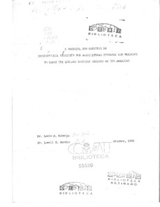
A proposal for creating an international institute for agricultural research and training to serve the lowland tropical regions of the Americas
A diagnostic study of agricultural land use in the Southwest Brazilian Amazon
Final Evaluation Report (Biodiversity Impact): Integrated Land and Ecosystem Management to Combat Land Degradation and Deforestation in Madhya Pradesh
The study assessed the biodiversity impact of the project supported by UNDP and the Government of Madhya Pradesh to support local communities in rehabilitating degraded forest, generating sustainable livelihoods and protecting the areas rich ecosystem. The project was supported by the Global Environment Facility.

