Resource information
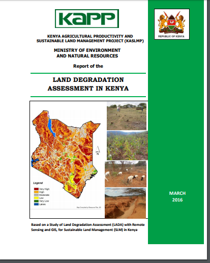
A summary of the findings of a study of land degradation assessment (LADA) with remote sensing (RS) and geographic information systems (GIS), and its implications for sustainable land management (SLM) in Kenya is presented. The assessment was conducted over a 6-month period in July-December 2015. The need for the LADA is in line with the Kenya Government’s strong interest in moving towards a country programmatic approach, for sustainable land management (SLM). The Kenya Vision 2030 stipulates the need for sustainable land use as part of the proposed land reforms, and espouses the establishment of a GIS-based land information system in order to track land patterns, among other things. In order to optimize this approach, the Government of Kenya has undertaken to develop a country strategic investment framework (CSIF) in sustainable land management within the Terrafrica guidelines. According to the Terrafrica guidelines, an assessment of the causes, types and impacts of land degradation are among the recommended diagnostic tools for informing the development of the Kenya Strategic Investment Framework (KSIF), necessary for providing evidence–based decision support for SLM planning. This is implemented through the Kenya Agricultural Productivity and Sustainable Land Management Project (KAPSLMP), which is a Government of Kenya project supported by the World Bank. This LADA is implemented to meet KAPSLMP’s Strategic Objective 3 on “Strengthening the policy, regulatory and supporting SLM and innovative incentive mechanisms such as payments for Environmental Services–PES”. Therefore, a spatially referenced GIS database/information system was developed as a tool for KAPSLMP and other stakeholders, for planning purposes and for informing the preparation of the KSIF. The main objective of the LADA project was to assess the causes, extent and types of land degradation in Kenya, with a view to developing and improving the knowledge base to make sound, accurate and timely decisions and planning for sustainable land management in Kenya. The development of the LADA was advised by a thorough reviews of literature from Government Ministries e.g. Ministry of Environment and Natural Resources, Ministry of Agriculture, Livestock and Fisheries Development, Ministry of Water and Irrigation, Ministry of Planning and Vision 2030, NEMA, WRMA and other statutory boards, bilateral and multilateral organizations, research institutes, NGOs active in the sector, and sources such as libraries and the internet. The literature reviews were used collect baseline data collection and to provide an understanding of the status, causes, types and extent of land degradation in the country. The LADA made use of RS and GIS tools to develop a computerized GIS-based LADA containing the base-line data at national scales. RS/GIS analyses were used to determine the extent of land degradation in Kenya, the major determinants, the areas undergoing most serious land degradation and the severity of land degradation and of land degradation in the country. The SLM interventions for national scale rehabilitation and/or prevention of degradation were assessed from review of literature, google maps and expert knowledge of the country. Some three case studies drawn from KAPSLMP’s project sites, i.e. Taita-Taveta, Kinale-Kikuyu and Cherangani Hills are also presented. In addition, the policy, institutional and market issues that contribute to and /or impact on land degradation in Kenya were assessed. This project developed a total of 47 thematic maps using RS/GIS tools, of which 30 maps have been used in this report. Based on availability of RS data, the base year was set from 1990 and compared with conditions in 2010, thus giving a 20-year period for assessing trends. The results of land use mapping show that the predominant land use-land cover (LULC) type is the Savannah grasslands, combining a wide range of vegetation types, as it covers about 69.7% of the land area of Kenya. This is followed by agriculture, both rainfed and irrigated, covering 17.7% of the land area, while about 2.2% of the land area of Kenya was found to be bare lands. Spatial analysis of the LULC changes showed an overall deterioration of vegetation cover over the last 20 year period, meaning that land degradation is occurring in Kenya. This was identified through declining vegetation cover as depicted by NDVI, increasing bare lands, conversion of natural vegetation into agricultural lands and soil erosion. Generally, agricultural/cultivated areas increased by 7.3% and bare lands increased by 2.6%. The greatest losses of vegetation occurred in the period 1990 - 2000, when at national scales, 0.8% of forest was lost, and bareland increased by 4%. Soil erosion risk mapping revealed that almost all the counties in Kenya are at risk from one form of land degradation or other. The problem is serious because high land degradation is likely to occur on about 61.4% the total area of Kenya, while very high degradation affects 27.2% of the land. Land degradation affects especially the ASALs, where the soils are highly erodible and combined with high intensity storms, creates conditions for excessive runoff and soil erosion. The most affected counties include Samburu, Kitui, Garissa, Tana River, Mandera, Turkana, Marsabit, Baringo, West Pokot, Kajiado, Kilifi, Wajir and Makueni. Even some relatively wetter zones also have high propensity for soil erosion, especially on steep slopes of Mt. Kenya and the Aberdares, including parts of Muranga, Nyeri, Meru and Tharaka-Nithi. On the contrary, low degradation risks were found to be on protected areas and those with relatively flat terrains yet having adequate rainfall. These include the forest zones, national parks, teagrowing areas and plateaus e.g. Uasin Gishu, Trans Nzoia and parts of Lake Victoria basin. Meanwhile, the causes of land degradation in Kenya are both natural and human induced. They include biophysical (natural) factors related to climatic conditions and extreme weather events such as droughts and floods, and catchment factors such as steep slopes and highly erodible soils. However, it is the human activities that pose greatest threat, and these include unsustainable land management practices (anthropogenic) factors such as destruction of natural vegetation, over-cultivation, overgrazing, poor land husbandry and excessive forest conversion. The SLM interventions for national scale rehabilitation and/or prevention of degradation have been aggregated under three broad categories, i.e. (i) Tree planting and reclamation of catchment areas, (ii) Soil and water conservation on croplands (including agronomic measures), and (iii) Rehabilitation of degraded rangelands. An analysis of the legal, regulatory policy and socio-economic issues impacting on land degradation and SLM was also done. It was found that a very large number of laws, policies, strategies, development plans and institutional frameworks exist, which mention land degradation and/or SLM either directly or indirectly. A number of the policies address soil erosion, protection of catchment areas, soil and water conservation, rainwater harvesting, tree planting and control of pollution. However, few Government Departments have put resources into SLM implementation, and even this, addresses mostly large infrastructure developments, e.g. dams. But, gaps also exist in terms of addressing sustainable land management in agricultural systems. For instance, although the Ministry of Agriculture, Livestock and Fisheries (MoALF) is the focal Ministry linking farmers to SLM, it does not host a single SAGA/parastatal dedicated to SLM issues, e.g. comparable to NEMA – which is affiliated to the Ministry of Environment and Natural Resources (MENR). Furthermore, there is no one stop-shop to address targeted investments for SLM for smallholder land users, and Kenya does not have a Country Strategic Investment Framework (CSIF) addressing SLM tacitly. Based on this, it was recommended that Kenya should develop a CSIF to facilitate fast-tracking of actions for SLM and to address the apparent gaps in investment for the sub-sector. This Report is structured in nine Chapters. Chapter-1 describes the context for developing the Kenya LADA. Chapter-2 provides the Methodology of how the LADA was conducted, Chapter-3 describes the baselines on Kenya, the salient bio-physical, economic and demographic features, utilizing thematic maps developed in this LADA study Chapter-4 provides the findings on the Extent of land degradation in Kenya, Chapter- 5 presents the findings on the major causes of land degradation, Chapter 6 presents the findings on types and extent of SLM interventions in Kenya, including the case studies, Chapter-7 discusses an overview of the national laws, policies and strategies that impact o land degradation and SLM in Kenya Chapter 8 provides as the Conclusions and Recommendations of the study. Chapter 9 contains the Annexes. Literature was cited and annotated as footnotes in the body of the report.