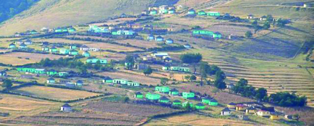
Communal Land Rights Act
To provide for the temporary protection of certain rights to and interests in land which are not otherwise adequately protected by law; and to provide for matters connected therewith
AGROVOC URI:
To provide for the temporary protection of certain rights to and interests in land which are not otherwise adequately protected by law; and to provide for matters connected therewith
In South Africa, policies of separate development and restrictions placed on capital expenditure imposed on the lands occupied by the indigenous people during the colonial era prevented the state from implementing the cadastre in the communal areas of the country. The status quo persists to this day, which has resulted in a dual system that promoted investment in areas where private property rights were permitted, but relegated the traditional communities into poverty and disinvestment
The Department of Rural Development and Land Reform (DRDLR) presented the Annual Report 2014/15 for the Communal Property Associations (CPAs). To date, 1 428 CPAs were registered, with 48 being registered in the last financial year. Challenges faced by CPAs included ongoing conflicts amongst CPA members which centred on governance issues, and the fact that some CPAs were insolvent and needed an injection of funds to put them on a sound footing. 29 CPAs were untraceable, 20 CPAs had lost (through sale or loss by attachment) 10 668 hectares of land, and nine CPAs were under administration.
The Committee received a presentation of the evaluation report on the implementation of the Comprehensive Rural Development Programme (CRDP) by the Department of Perfomance, Monitoring and Evaluation (DPME). The National Evaluation Plan (NEP) containing 52 evaluations that cut across government had been approved by Cabinet in 2012/13. There were eight evaluations in the rural development sector and the CRDP was one of the key programmes implemented since 2009.
El presente trabajo forma parte de un acumulado de acciones y luchas colectivas que venimos desarrollando las organizaciones sociales Consejo Cívico de Organizaciones Populares e Indígenas de Honduras (COPINH), Organización Fraternal Negra Hondureña (OFRANEH) y Jubileo Sur Américas (JS/A), y ha contado con el apoyo técnico del Transnational Institute (TNI).
This publication outlines the process undertaken by UN Habitat/GLTN and The United Nations Food and Agriculture Organization (FAO) Representation in Kenya to support the Ministry of Lands, Physical Planning and Urban Areas Management of the Turkana County Government-Kenya, in establishing a county Land Information Management System based on the Social Tenure Domain Model (STDM). The project was carried out in the context of the United Nations Food and Agriculture Organization (FAO) program entitled, Support for Responsible Land and Natural Resource Governance of Communal Lands in Kenya.
As desigualdades de desenvolvimento e suas dinâmicas possuem razões políticas, económicas e sociais de longa duração. Estes factores influenciam os percursos históricos sobre as quais as políticas económicas e os poderes políticos procuram influenciar conjunturalmente sem que, na maioria dos casos, sejam efectivas mudanças fundamentais nas sociedades.
As desigualdades sociais e territoriais têm implicações sobre a estrutura e as dinâmicas do crescimento/desenvolvimento económico, sobre a estabilidade política e social e sobre a sustentabilidade ambiental, entre outros aspectos.
O ritmo migratório rural-urbano é frequentemente superior à taxa de crescimento natural dapopulação citadina, em resultado da procura de oportunidades de emprego por parte daspopulações rurais, o que reflecte (e cria novas) pressões sociais e económicas.Ao longo deste texto procura-se compreender os factores que levam as populações de origemrural a migrar para a cidade de Maputo, assim como compreender as dinâmicas de relacionamentodas mesmas, uma vez na cidade, com o seu universo de origem.
O texto pretende analisar a distribuição do grande investimento económico pelos diferentes distritos da província de Tete, procurando identificar impactos socio-económicos, a emergência de novos problemas sociais e respectivas formas de protesto. Na análise constata-se a concentração do grande investimento no eixo Tete-Moatize, a reboque da indústria extractiva, alimentando assimetrias sócio-espaciais e atraindo movimentos migratórios, que concorreram para a saturação das infraestruturas urbanas.
THE WILDLIFE CONSERVATION AND MANAGEMENT ACT, 2013 No. 47 of 2013
Date of Assent: 24th December, 2013
Date of Commencement: 10th January, 2014
THE COMMUNITY LAND ACT No. 27 of 2016
Date of Assent: 3lst August,2016
Date of Commencement : 2 I st September, 201 6
Moçambique localiza-se na costa sudueste de África, com uma área de cerca de 799.380 Km1 e uma linha costeira de cerca de 2.515 Km ao longo do Oceano Índico, constituindo um espaço vital tanto para o país assim como para os países vizinhos situados no interior que só têm acesso às vias oceânicas através dos portos moçambicanos. Em termos de fronteiras, o país faz limite, a Norte, com a República Unida da Tazânia, a Oeste com o Malawi, Zâmbia, Zimbabwe, Suazilândia e República da Àfrica do Sul; a Sul, faz divisa com a Àfrica do Sul, países com os quais partilha cerca de 4.330Km.