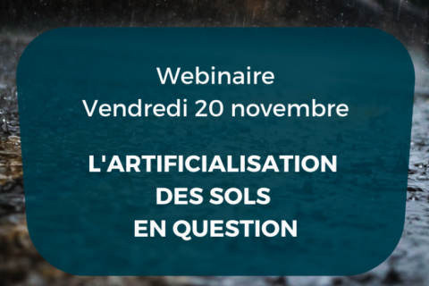
Aller au contenu principal

page search

There are 9, 777 content items of different types and languages related to utilisation des terres on the Land Portal.
Displaying 37 - 42 of 42

P 26: LANDS OF THE FUTURE – FUTUREMAKING WITH PASTORALISTS IN AFRICA

08 Juin 2021

Positive futuremaking starts when space, time and land with its inhabitants are brought and thought together, when diverse forms of life on, with and off the land can be accepted as valid elements of futuremaking; when unnecessary distinctions among livelihoods and forms of existence are overcome; and when all members of society are trusted to cooperate to build states on peaceful terms.

Découvrir les opportunités de données foncières : Les cas du Sénégal et de la Namibie

22 Novembre 2022

Le webinaire partagera les derniers résultats du pilote de mise en œuvre du Guide Open Up au Sénégal et de la recherche SOLI en Namibie. Nous poserons et répondrons à des questions pressantes concernant l'intérêt et la maturité des données ouvertes dans les deux pays et spécifiquement dans le secteur foncier. 

Land Portal Foundation
Deutsche Gesellschaft für Internationale Zusammenarbeit (GIZ) GmbH
Government of Senegal
Open Data Charter

Copernicus Land User Event

17 Novembre 2022 - 18 Novembre 2022
Bedford Hotel & Congress Centre
Rue du Midi 135,1000 Bruxelles
Belgium

Copernicus Land User Event - Register now!

European and global land surface applications

Copernicus Land Monitoring Service

Fundamentals of Machine Learning for Earth Science

19 Avril 2023 - 03 Mai 2023

NASA’s Applied Remote Sensing Training Program (ARSET) has opened a new online introductory webinar series: Fundamentals of Machine Learning for Earth Science. This three-part training, presented in English and Spanish, is open to the public and will provide attendees an overview of machine learning in regards to Earth Science, and how to apply these algorithms and techniques to remote sensing data in a meaningful way. Attendees will also be provided with end-to-end case study examples for generating a simple random forest model for land cover classification from optical remote sensing. We will also present additional case studies to apply the presented workflows using additional NASA data.