Resources
Displaying 1451 - 1455 of 2258Can Rock-Rubble Groynes Support Similar Intertidal Ecological Communities to Natural Rocky Shores?
Despite the global implementation of rock-rubble groyne structures, there is limited research investigating their ecology, much less than for other artificial coastal structures. Here we compare the intertidal ecology of urban (or semi-urban) rock-rubble groynes and more rural natural rocky shores for three areas of the UK coastline. We collected richness and abundance data for 771 quadrats across three counties, finding a total of 81 species, with 48 species on the groynes and 71 species on the natural rocky shores.
Delivering Climate-Development Co-Benefits through Multi-Stakeholder Forestry Projects in Madagascar: Opportunities and Challenges
This paper explores multi-stakeholder perspectives on the extent to which forestry projects that pursue ecological restoration and rehabilitation in Madagascar engage with local communities and can co-deliver climate-development benefits. Drawing on mixed methods (policy analysis, semi-structured interviews, participatory site visits and focus groups) in two different forestry contexts, we show that by strengthening access to capital availability, projects can enhance local adaptive capacity and mitigation and deliver local development.
A Comparative Analysis of a Detailed and Semi-Detailed Soil Mapping for Sustainable Land Management Using Conventional and Currently Applied Methodologies in Greece
Two soil mapping methodologies at different scales applied in the same area were compared in order to investigate the potential of their combined use to achieve an integrated and more accurate soil description for sustainable land use management. The two methodologies represent the main types of soil mapping systems used and still applied in soil surveys in Greece. Diomedes Botanical Garden (DBG) (Athens, Greece) was used as a study area because past cartographic data of soil survey were available.
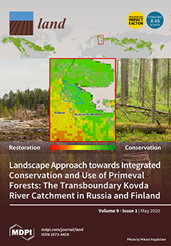
Landscape Approach towards Integrated Conservation and Use of Primeval Forests: The Transboundary Kovda River Catchment in Russia and Finland
Regional clear-felling of naturally dynamic boreal forests has left remote forest landscapes in northern Europe with challenges regarding rural development based on wood mining. However, biodiversity conservation with higher levels of ambition than what is possible in regions with a long forest history, and cultural heritage, offer opportunities for developing new value chains that support rural development.
Mass Appraisal Modeling of Real Estate in Urban Centers by Geographically and Temporally Weighted Regression: A Case Study of Beijing’s Core Area
The traditional linear regression model of mass appraisal is increasingly unable to satisfy the standard of mass appraisal with large data volumes, complex housing characteristics and high accuracy requirements. Therefore, it is essential to utilize the inherent spatial-temporal characteristics of properties to build a more effective and accurate model. In this research, we take Beijing’s core area, a typical urban center, as the study area of modeling for the first time.


