Land Degradation Risk Assessment for Sustainable Rangeland Restoration in Jordan
Resource information
Date of publication
марта 2018
Resource Language
ISBN / Resource ID
mel:20.500.11766/10188
License of the resource
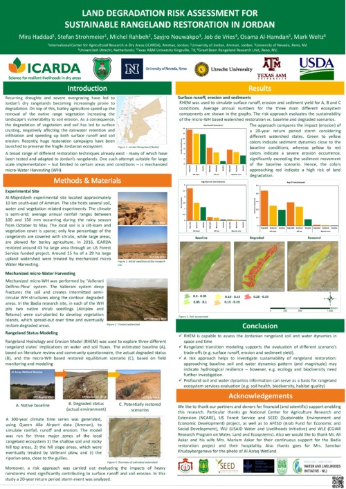
Rangeland Hydrology and Erosion Model (RHEM) was used to explore three different rangeland states’ implications on water and soil fluxes. The estimated baseline (A), based on literature review and community questionnaire, the actual degraded status (B), and the micro-WH based restored equilibrium scenario (C), based on field monitoring and modeling
A 300-year climate time series was generated, using Queen Alia Airport data (Amman), to simulate rainfall, runoff and erosion. The model was run for three major zones of the local rangeland ecosystem 1) the shallow soil and rocky hill top areas, 2) the hill slope areas, which were eventually treated by Vallerani plow, and 3) the riparian area, close to the gullies.
Geographical focus