Os conjuntos de dados abaixo foram extraídos de uma ampla gama de fontes de informações internacionais e abrangem um espectro igualmente extenso sobre temas e questões relacionados com a terras. Utilize os diferentes filtros para iniciar sua busca dentro desta exclusiva coleta de dados abertos.
Land Matrix - Large-Scale Land Acquisitions
This dataset contains information provided by the Land Matrix on the size, purpose, year and location of Large-Scale Land Aquisitions around the world.
--> The data below has been updated until 2022.
Dataset provider:
Dataset provider:
LandMark - Geospatial Dataset Indigenous & Community lands
LandMark: The Global Platform of Indigenous and Community Lands displays georeferenced information on collectively-held and used lands worldwide. It consolidates the numerous ongoing local, national, and regional efforts to map and document indigenous and community lands within a single global platform.
Dataset provider:
Dataset provider:
LCW - Land Conflicts in India
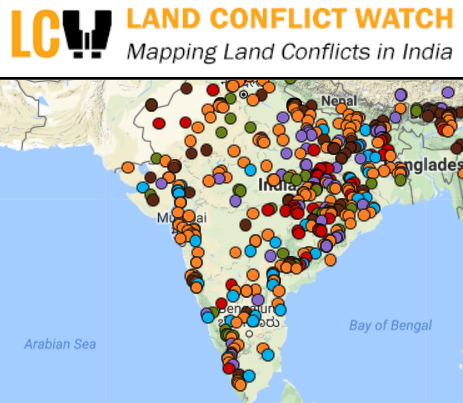
Land Conflict Watch is a research-based data journalism project that maps, collects, and analyses ongoing land conflicts in India.
Dataset provider:
Dataset provider:
LMAF - Lao Census of Agriculture
The Lao Census of Agriculture 2010/11 was the second agricultural census undertaken in the Lao PDR. Since the first in 1998/99, the agricultural sector underwent significant changes.
Dataset provider:
Dataset provider:
LMM - Indicators of the Legal Security of Indigenous and Community Lands
The dataset "Indicators of the Legal Security of Indigenous and Community Lands" is characterized by a series of ten indicator questions that point to the security of land tenure for Indigenous Peoples or communities as established in national laws.
Dataset provider:
Dataset provider:
LMM - Percent of Indigenous and Community Lands
The dataset "Percent of Indigenous and Community Lands" contains the estimated area of land held or used by Indigenous Peoples and non-indigenous communities per country as a percentage of the country’s total land area. The data are divided into three categories, each of them correspond to an indicator on the LB.
Dataset provider:
Dataset provider:
Notre Dame Global Adaptation Initiative
The Notre Dame-Global Adaptation Index (ND-GAIN) Country Index is a free opensource index that shows a country’s current vulnerability to climate disruptions. It also assesses a country’s readiness to leverage private and public sector investment for adaptive actions.
Dataset provider:
Dataset provider:
NRGI - Resource Governance Index
The Resource Governance Indexes, developed by NRGI, measures the quality of countries' resource governance. In 2017, these indexes measures the quality of resource governance in 81 countries that together produce 82 percent of the world’s oil, 78 percent of its gas and a significant proportion of minerals, including 72 percent of all copper.
Dataset provider:
Dataset provider:
OECD - Social Institutions and Gender Index (SIGI) Database 2019
The Social Institution and Gender Index (SIGI) dataset address the de jure and de facto situations of discriminatory social institutions, combining both qualitative and quantitative data providing information information
Dataset provider:
Dataset provider:
OECD - Social Institutions and Gender Index Database
Also known as the Gender, Institutions and Development Database - OECD, the SIGI dataset address the de jure and de facto situations of discriminatory social institutions across five sub-indices: discriminatory family code, restricted physical integrity, son bias, restricted resources and assets, and restricted civil li
Dataset provider:
Dataset provider:
PrIndex - Global Property Rights Index
PRIndex stands for the Global Property Rights Index, an indicator of citizens' perceptions of the security of property rights, and this page only displays the results of the first pilot and testing phase run in 2016-2017
Dataset provider:
Dataset provider:
Prindex - Global Property Rights Index - 2019/2020
Prindex stands for the Global Property Rights Index, an indicator of citizens' perceptions of the security of land and property rights.
Dataset provider:
Dataset provider:
RRI - Forest Tenure Data

The quantitative dataset on forest tenure data by RRI currently covers 58 countries. The data covers the period 2002-2017. RRI monitors spatial forest tenure data - that is, who owns how many hectares of a given forest - and recognizes four categories of land ownership:
Dataset provider:
Dataset provider:
SDG 1.4.2

The data included in this dataset reflects indicator 1.4.2 of the Sustainable Development Goals (SDGs), which measures the proportion of total adult population with secure tenure rights to land, with legally recognized documentation and who perceive their rights to land as secure, by sex and by type of tenure.
Dataset provider:
Dataset provider:
SDG 11.1.1
The data included in this dataset reflects indicator 11.1.1 of the Sustainable Development Goals (SDGs), which measures the proportion of urban population living in slums, informal settlements or inadequate housing.
Dataset provider:
Dataset provider:
SDG 15.1.2 - Proportion of important sites for terrestrial and freshwater biodiversity that are covered by protected areas, by ecosystem type

The data included in this dataset reflects indicator 15.1.2 of the Sustainable Development Goals (SDGs), which measures the proportion of important sites for terrestrial and freshwater biodiversity that are covered by protected areas, by ecosystem type.
Dataset provider:
Dataset provider: