Aller au contenu principal

page search

There are 4, 190 content items of different types and languages related to développement durable on the Land Portal.
Displaying 49 - 60 of 67

Stockholm+50

02 Juin 2022

Stockholm+50 : une planète saine pour la prospérité de toutes et tous - notre responsabilité, notre chance"

Site web officiel : https://www.stockholm50.global/

(Stockholm+50) est une réunion internationale convoquée par l'Assemblée générale des Nations unies qui se tiendra à Stockholm, en Suède, les 2 et 3 juin 2022.


United Nations Environment Programme

Remote Sensing for Measuring Urban Heat Islands and Constructing Heat Vulnerability Indices

02 Août 2022 - 11 Août 2022

Structures such as buildings, roads, and other infrastructure absorb and re-emit the sun’s heat more than natural landscapes such as forests and water bodies. Urban areas, where these structures are highly concentrated and greenery is limited, become “islands” of higher temperatures relative to outlying areas.

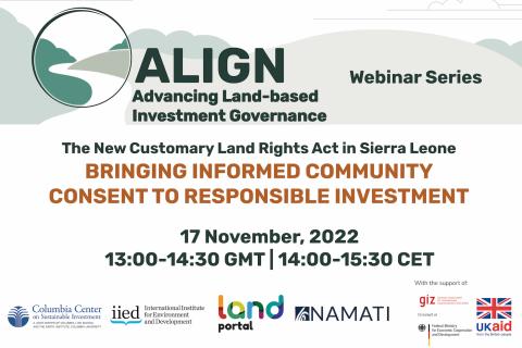
La nouvelle loi sur les droits fonciers coutumiers en Sierra Leone : Apporter le consentement éclairé de la communauté à l'investissement responsable

17 Novembre 2022

En septembre 2022, la Sierra Leone a promulgué des lois sans précédent relatives à la terre, au climat et au développement durable. Cette nouvelle loi transforme la capacité des communautés à protéger leurs droits fonciers et à poursuivre le développement durable. Ce webinaire abordera les processus, les expériences, les défis et le contexte de cette nouvelle loi, en soulignant les nouvelles responsabilités en Sierra Leone.

Columbia Center on Sustainable Investment
International Institute for Environment and Development
Land Portal Foundation
Namati

ILDC 2022 : Des pressions mondiales sur les terres locales : Perspectives du Sud

07 Décembre 2022 - 09 Décembre 2022

Le thème de la sixième édition de l'ILDC en 2022 est "Global Pulls on Local Lands : Southern Perspectives". L'objectif est de poursuivre et d'élargir la portée des échanges Sud-Sud autour des conversations et des coopérations sur les terres, qui ont débuté lors du dernier épisode, tandis que l'accent des délibérations continuera d'être mis sur l'Inde.

NRMC

LDC 2022 : Les pressions mondiales sur les terres locales : Perspectives du Sud

07 Décembre 2022 - 09 Décembre 2022

Le thème de la sixième édition de l'ILDC en 2022 est "Global Pulls on Local Lands : Southern Perspectives". L'objectif est de poursuivre et d'élargir la portée des échanges Sud-Sud autour des conversations et des coopérations sur les terres, qui ont débuté lors du dernier épisode, tandis que l'accent des délibérations continuera d'être mis sur l'Inde.

NRMC

Post COP27: Réflexion sur les promesses des donateurs aux gardiens de la forêt

01 Décembre 2022

Ce dernier webinaire de la série Land Dialogues 2022 aura lieu après la Conférence des Nations Unies sur le changement climatique COP 27 (6 - 18 novembre, Sharm El-Sheik). Une promesse historique de 1,7 milliard de dollars ayant été faite lors de la COP26 de l'année dernière par le Forest Tenure Funders Group pour faire progresser les droits fonciers des peuples autochtones et des communautés locales ainsi que leur garde forestière, il est important que nous discutions des défis et des opportunités dans le contexte de ces avancées importantes. Le webinaire "Post COP27 : Reflecting on Donor Promises to Forest Guardians" servira de plate-forme pour réfléchir aux progrès réalisés, aux lacunes et à la question de savoir si la promesse de 1,7 milliard de dollars faite lors de la COP26 a été respectée lors de la COP27.

Land Portal Foundation
The Tenure Facility
Thomson Reuters Foundation
Ford Foundation

Crop Mapping using Synthetic Aperture Radar (SAR) and Optical Remote Sensing

03 Avril 2023 - 12 Avril 2023

NASA’s Applied Remote Sensing Training Program (ARSET) has opened a new online advanced webinar series: Crop Mapping using Synthetic Aperture Radar (SAR) and Optical Remote Sensing. This three-part training, presented in English and Spanish, is open to the public and builds on previous ARSET agricultural trainings. Here we present more advanced radar remote sensing techniques using polarimetry and a canopy structure dynamic model to monitor crop growth. The training will also cover methods that use machine learning methods to classify crop type using a time series of Sentinel-1 & Sentinel-2 imagery. This series will include practical exercises using the Sentinel Application Platform (SNAP) and Python code written in Python Jupyter Notebooks, a web-based interactive development environment for scientific computing and machine learning.

Fundamentals of Machine Learning for Earth Science

19 Avril 2023 - 03 Mai 2023

NASA’s Applied Remote Sensing Training Program (ARSET) has opened a new online introductory webinar series: Fundamentals of Machine Learning for Earth Science. This three-part training, presented in English and Spanish, is open to the public and will provide attendees an overview of machine learning in regards to Earth Science, and how to apply these algorithms and techniques to remote sensing data in a meaningful way. Attendees will also be provided with end-to-end case study examples for generating a simple random forest model for land cover classification from optical remote sensing. We will also present additional case studies to apply the presented workflows using additional NASA data.


Application of NASA SPoRT-Land Information System (SPoRT-LIS) Soil Moisture Data for Drought

16 Mai 2023 - 30 Mai 2023

NASA’s Applied Remote Sensing Training Program (ARSET) has opened a new open, online webinar series: Application of NASA SPoRT-Land Information System (SPoRT-LIS) Soil Moisture Data for Drought. This 3-part webinar series is focused on the introduction of the NASA Land Information System (LIS) output of soil moisture at various depths for drought analysis and monitoring. Examples from operational applications as well as practice exercises (for using LIS data for drought monitoring) will be included in this course. Access to the SPoRT-LIS products via online viewer, in GIS formats, and GIS-based display tools, will also be included. Moreover, self-paced microlessons will be available to help users confirm their understanding and improve their skill via homework lessons between live sessions.