Resources
Displaying 1961 - 1965 of 2258A Stakeholders’ Analysis of Eastern Mediterranean Landscapes: Contextualities, Commonalities and Concerns
This study aims at demonstrating and critically assessing high-level landscape stakeholders’ perceptions and understandings of landscape-related issues, threats and problems, in the Eastern Mediterranean, through a purposive comparative research survey of four case studies: Cyprus, Greece, Jordan and Lebanon.
Mapping Land Cover and Estimating the Grassland Structure in a Priority Area of the Chihuahuan Desert
A field characterization of the grassland vegetation structure, represented by the coverage of grass canopy (CGC) and the grass height, was carried out during three years (2009–2011) in a priority area for the conservation of grasslands of North America. Landsat Thematic Mapper (TM5) images were selected and the information of reflectance was obtained based on the geographical location of each field-sampling site.
What’s (Not) on the Map: Landscape Features from Participatory Sketch Mapping Differ from Local Categories Used in Language
Participatory mapping of local land use as the basis for planning and decision-making has become widespread around the globe. However, still relatively little is known about the conceptual underpinnings of geographic information produced through participatory mapping in given cultural and linguistic settings. In this paper, we therefore address the seemingly simple question of what is (not) represented on maps through an exploratory case study comparing land use categories participants represented on sketch maps with categories elicited through more language-focused ethnographic fieldwork.
Water Rights on Community Lands: LandMark’s Findings from 100 Countries

This paper analyzes whether national laws acknowledge indigenous peoples and other rural communities in 100 countries as owners of waters that arise within their lands. Results derive from information collected by LandMark to score the legal status of community land tenure. Findings are positive; half of all countries recognize communities as lawful possessors of water on their lands. Three quarters permit communities to manage the distribution and use of water on their lands.
Informal Urban Green Space: Residents’ Perception, Use, and Management Preferences across Four Major Japanese Shrinking Cities
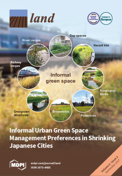
Urban residents’ health depends on green infrastructure to cope with climate change. Shrinking cities could utilize vacant land to provide more green space, but declining tax revenues preclude new park development—a situation pronounced in Japan, where some cities are projected to shrink by over ten percent, but lack green space. Could informal urban green spaces (IGS; vacant lots, street verges, brownfields etc.) supplement parks in shrinking cities?