/ library resources
Showing items 1 through 9 of 2133.
Monitoring of irrigated land cover is important for both resource managers and farmers. An operational approach is presented to use the satellite-derived surface temperature and vegetation cover in order to distinguish between irrigated and non-irrigated land.
A framework was developed to elucidate (1) the drivers of land degradation, (2) pressures, (3) local impacts and vulnerabilities and (4) adaptation strategies.
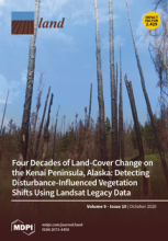
Across Alaska’s Kenai Peninsula, disturbance events have removed large areas of forest over the last half century. Simultaneously, succession and landscape evolution have facilitated forest regrowth and expansion.
Drastic growth of urban populations has caused expansion of peri-urban areas—the transitional zone between a city and its hinterland.
Mountainous regions are more sensitive to climatic condition changes and are susceptible to recent increases in temperature. Due to urbanization and land use/land cover (LULC) issues, Cameron Highlands has been impacted by rising land surface temperature (LST) variation.

There is a growing interest for scientists and society to acquire deep knowledge on the impacts from environmental disasters.
Development has fragmented urban nature, and target sites for conservation strategies need to be those that have long maintained their original land cover in a clustered area.
There are many new land use and land cover (LULC) products emerging yet there is still a lack of in situ data for training, validation, and change detection purposes.
Rapid urbanisation in China has led to massive outmigration in rural regions, which has changed the regional labour force structure and can have various profound impacts as a result.
Land Library Search
Through our robust search engine, you can search for any item of the over 73,000 highly curated resources in the Land Library.
If you would like to find an overview of what is possible, feel free to peruse the Search Guide.