Land Library
Bienvenue dans la bibliothèque du Land Portal. Explorez notre vaste collection de ressources en libre accès (plus de 74 000), comprenant des rapports, des articles scientifiques, des articles de recherche, des publications évaluées par des pairs, des documents juridiques, des vidéos et bien plus encore.
/ library resources
Showing items 73 through 81 of 127.
A presentation on the effects of the 3-S hydropower development on water access, available land resources and impacts on food production.
A discussion paper by Robyn Johnston, Michael Roberts, Thuon Try and Sanjiv de Silva on groundwater for irrigation in Cambodia, published by International Water Management Institute, Colombo, Sri Lanka, iDE Cambodia in June 2013.
The research employs case studies to grasp the processes and forms of ongoing land consolidation, factors affecting land consolidation, viewpoints on land consolidation and impacts of land consolidation on stakeholders and the society.
The Myanmar government introduced two new land laws in 2012 as part of an effort to liberalize land markets. This report analyzes the implementation of these laws using theory, field research, and a comparative regional analysis. It also offers recommended interventions.

THE WILDLIFE CONSERVATION AND MANAGEMENT ACT, 2013 No. 47 of 2013
Date of Assent: 24th December, 2013
Date of Commencement: 10th January, 2014
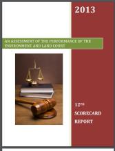
Dispute resolution is a key component of land administration and management in Kenya. Article 162 of the Constitution of Kenya provides for the establishment of the Environment and Land Court (ELC) by an Act of Parliament.

The application of computer technology in land administration is touted as one way of ensuring efficient and transparent land administration.

The Cadastral system in Kenya was established in 1903 to support land alienation for the white settlers who had come into the country in the early part of the 20th Century.

The cadastral system in Kenya was established in 1903 to cater for land alienation for the white settlers. Since then, a hundred years later, the structure of the system has remained more or less the same despite major changes in surveying technology.